Atlanta, Georgia – A multi-day rain event is taking shape across Georgia, and forecasters say the setup could bring some of the heaviest rainfall the region has seen in weeks, raising concerns over flash flooding in both urban and rural areas.
Meteorologists tracking the pattern say a plume of tropical moisture pulling north from the Gulf is expected to settle over the state, with the most significant impacts building Thursday into Friday. Rain chances are climbing sharply, with several forecasts now placing probabilities at 80 percent or higher across much of central and west Georgia, including Atlanta and surrounding metro communities.
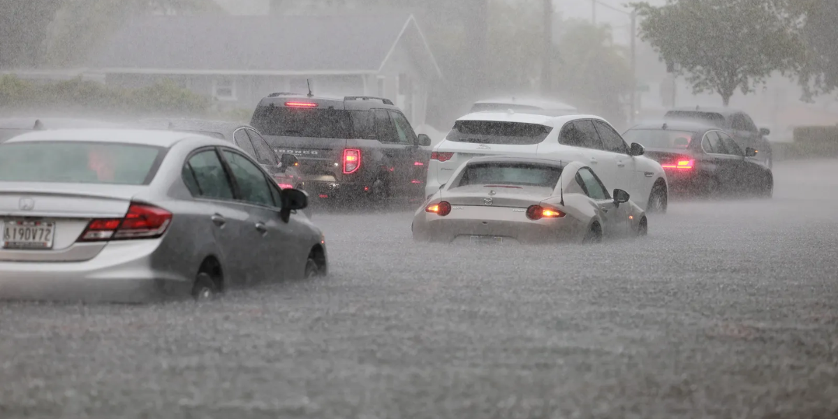
What has forecasters most concerned is not just the amount of rain, but how it will fall. Repeated rounds of downpours moving over the same areas, sometimes called training storms, can produce rainfall rates of one to three inches per hour. When that happens over already saturated ground, water has nowhere to go, which sharply raises the risk of flash flooding in low-lying neighborhoods, urban corridors and areas with poor drainage.
Widespread rainfall totals of two to four inches are possible by the end of the week, with isolated higher amounts in spots that see multiple rounds of heavy storms. Communities south of Interstate 20 are currently viewed as most vulnerable to the heaviest, most persistent bands, though the exact placement of the worst weather could still shift as the system develops.
Officials are urging residents across metro Atlanta and beyond to stay alert in the coming days. Storm drains should be cleared of debris where possible, and drivers are being warned never to attempt crossing a flooded roadway, since water depth can be deceptive and dangerous even at low speeds.
Beyond the flooding risk, forecasters say they cannot completely rule out stronger thunderstorms forming within the moisture-rich pattern, which could bring gusty winds in addition to heavy rain.
With confidence growing in the forecast, additional flood watches or weather alerts may be issued for parts of the state as the week progresses. Residents are advised to keep a close eye on changing conditions through Thursday and Friday, when the threat is expected to peak.