Lake Charles, Louisiana — Southwest Louisiana is facing one of its most serious multi-day flood threats in recent memory, and meteorologists warn the worst may still be several days away.
Beginning this week and extending through Friday, a combination of Gulf moisture and a stalled frontal boundary is expected to trigger repeated waves of heavy rainfall across the Lake Charles region — conditions that forecasters say could push isolated rainfall totals to 8 to 10 inches before the week is out.
The threat is unfolding in two separate but compounding phases. The first round of heavy rain is already underway and expected to continue through Tuesday night, dumping an estimated 3 to 5 inches across much of southwest Louisiana and southeast Texas. Communities including Lake Charles, Leesville, Opelousas, Alexandria, Beaumont, and Port Arthur are all in the impact zone.
What makes this situation especially dangerous is the back-to-back nature of the storm systems. Wednesday may bring a brief pause in rainfall, but forecasters are careful to note that heavy showers will remain possible even during the break — and areas already saturated from the first round will be far more vulnerable when the second system strikes Thursday into Friday.
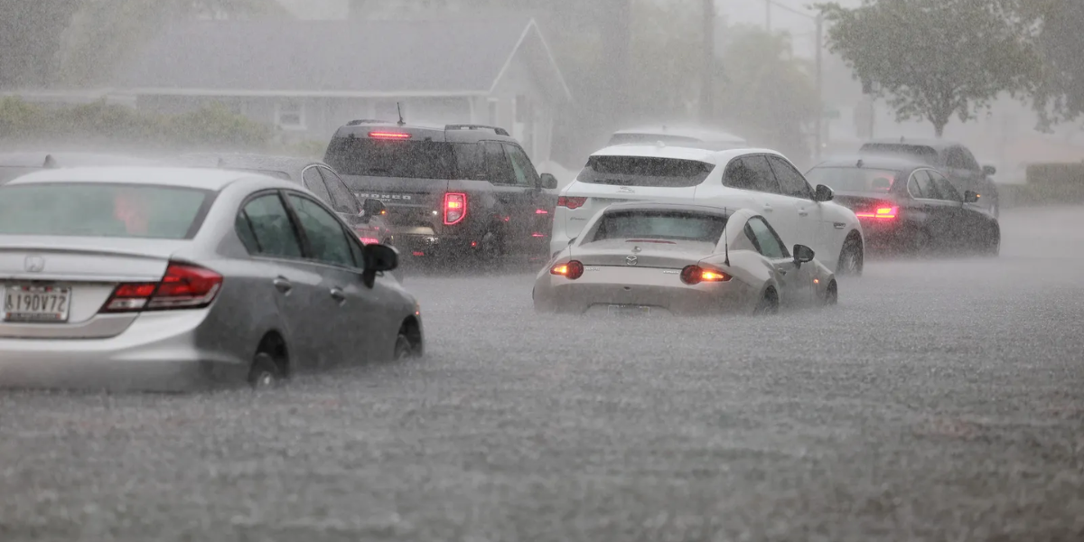
Drainage systems in urban areas and low-lying neighborhoods face the highest risk, as intense downpours are expected to overwhelm infrastructure already stressed from earlier rainfall. Rapidly rising water levels and flooded roadways are considered likely in the most affected zones.
Residents across the region are urged to monitor conditions closely, have multiple ways to receive emergency alerts, and avoid driving through any standing water on roadways. Officials warn that flood conditions can develop quickly and change without notice.
Additional watches and warnings are expected to be issued as rainfall accumulates. Do not wait for an official warning before taking precautions — by the time one is issued, conditions may already be dangerous.